Description
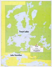
Size 17″ x 22″, Scale 2-1/8″ = 1 mile, Waterproof*
A detailed, enlarged map of Trout and surrounding lakes. Lake bottom contours are shown at depth intervals of 20 feet. The adjacent portion of Lake Vermilion and connecting motorized portage are also shown. Bold lake names shown not actually printed on map.
Lakes On Map
Lake Vermilion
Trout Lake
Reviews
There are no reviews yet.